
| Date | 10/9/2026 |
| Location / Trail | Baty Butte Trail - 545 |
| Weather | Overcast - Foggy at times with a little rain |
| Hiking Buddies | Thor |
| Start / End | 10:30 AM – 2:00 PM |
| Distance / Elev | 6 miles 1500 ft elevation |
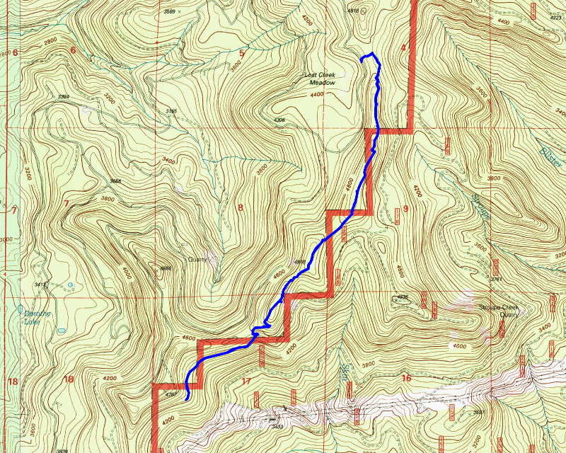
Today’s hike was simply a “get out in the woods on a fall day and enjoy the scenery” outing. We have had a slew of beautiful, unseasonably warm fall weather, but today marked a departure from recent trends. It was forecast to rain – but not too much. I thought a bit of rain might be refreshing, so I scoured maps for a candidate trail. Baty Butte is always neat in the fall and is a higher elevation trail, so I thought it would be a good choice. Since road 46 is still closed, the only access point is from the Molalla side – but it is great that you can get to this trail from there.
We headed out a bit early since the rain was supposed to come in mid day. The forecast was for light rain (less than a tenth of an inch) so it seemed like we wouldn’t get soaked – and a rainy day can be kind of interesting on a trail. The first surprise happened as we were headed up the Lost Creek Meadows road (it takes off the Joyce Lake road) – we encountered 6 or 7 trucks going up this road! It was crazy! My son said that since a lot of the Clackamas is still closed that many hunters are probably heading up the Molalla – I’m guessing he was right since they were all hunters.
We got to the trailhead, suited up and headed up the trail. I rushed off up the trail and forgot my phone on the cover of my truck. We got up a little ways and I realized I had forgotten it so we turned around and headed back down. By the time we got back to the truck, one of the hunters had parked near me and we ended up chatting for a bit. He was going to head north on Baty Butte to see what he could find – we were going to head south. We chatted for a while and then I said we should probably get going before it started raining.
We go up to the dozer line from the 2024 Sandstone fire and I had to take a picture – we were heading up into the mist:

We continued past that spot and headed up the first steep (but short) ascent up to the ridge. Walking along the ridge you soon get to a few nice viewpoints – well, they are good viewpoints most days, but today, looking back at Thunder Mountain it was totally in the clouds – nothing to see here today:

We continued up the trail – thus far, there had been no rain – just a very light foggy mist at times. We soon got up to the series of ridgetop “corridors” which I always enjoy:

A bit farther up, in another one of these corridors is a very interesting spot on this trail – I’m pretty sure there was a trail junction here at some point in its history – but I’ve not been able to find a map that shows another trail here – since this was most likely an old indian route it is possible it pre-dates the maps I’ve seen:

We soon got to the high point of the trail and then started heading down. As you head down to the saddle and the “green area” where all the carnage happened last winter, you pass a rocky outcropping that is to the west of the trail as it heads down. I decided to head up to the top of that outcropping just to see if you could see anything – not sure if you might be able to see something on a good day, but today you could see nothing – this was looking west to the Molalla drainage:

We continued down the trail and it was getting close to lunchtime – I was getting hungry, so I looked for a spot for lunch. Originally I was thinking we could eat at the powerline corridor but that would have been a very late lunch so as we were passing a rocky outcropping area it looked like a good spot for lunch. This was kind of our view at lunch – looking down to the powerlines:

After lunch, we packed up and continued down the trail. It hadn’t started raining yet but it was looking increasingly threatening. We headed downhill and soon got to the saddle that had all the carnage from last winter – I think we counted at least 30 trees that came down in this one small area:

We made it thru that area – and continued down into the “green area” – I moved some branches that were still on the trail above the green area. The green area, which had been aggressively cut back last year is growing back – the thimbleberry in here just goes crazy – it will need to be aggressively cut back again soon:

After getting thru the green area, the trail is relatively level for a while and then it hits an old, weird “cut but not a cut” area. This area was cut many years ago, but it wasn’t a clearcut – and it wasn’t a thinning. There are trees left, but not a lot. I’m not sure what the thought behind it was, but it is a strange area. Anyway, this area had gotten pretty rough, but had a good bit of work done on it last year as well. We got here and I paused – I was looking at what time it was and the weather. While I had wanted to get to the powerlines, I was concerned that we wouldn’t make it back in time to get home on time. It had also started to drizzle a bit. I made the decision that this would be our turnaround point:

That turned out to be a very good call – not for time, but for the weather. It was lightly drizzling when we turned around but the rain picked up a bit – didn’t get much rain in the trees, but any open areas were getting real rain. It wasn’t heavy, but it was more than just a little drizzle. I wasn’t really in the mood to get soaked, so turning around was a good idea.
We headed back up the hill, made it thru the green area and the long climb up to the high spot. This used to be what they called a helispot back in the day which is why it is cleared off. I was looking around in here and I noticed one of the nails that used to hold down the yellow triangle that was here for the landing spot:

I actually found all 3 of the nails that made up the triangle – it was interesting to find that – I never noticed it before.
As we walked back, I took this picture of an old campsite in a flat area along a bluff:

The rain continued pretty much the whole way back. While it wasn’t a heavy rain, it was enough to make some puddles on the trail:

We got back to the truck quite a bit faster than I expected. Time wise, I think we could have gone to the powerlines and still been back on time, but if we had done that, we would have gotten quite a bit wetter than we did.
It was a relatively short day but I really enjoyed it. Even in the fog and rain this trail is a beautiful trail to hike. With all the recent work done to it, it is even more enjoyable. I’m glad I chose this trail for today’s hike!