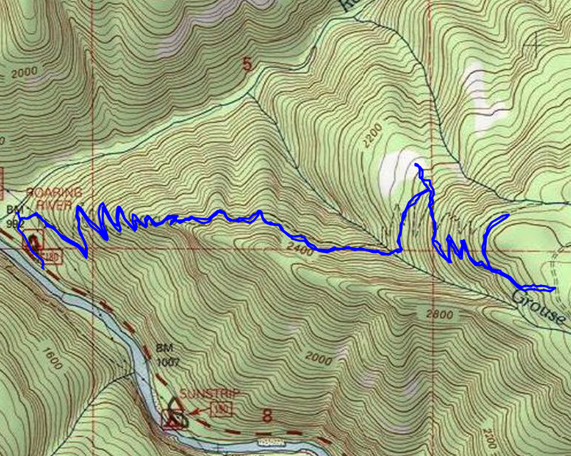
Location of Hike: Dry Ridge Trail
Trail Number: 518
Weather during Hike: Sunny and cold
Hiking Buddies: Kirk, Ollie and Thor
Start Time: 10:00 AM End Time: 4:10 PM
Hike Distance: 6.8 miles Elevation Gain: 2700 feet
We started at our normal time and made it to the trailhead (in the Roaring River Campground). Since the campground is closed due to the fires, we parked on the road and walked thru the remains of the campground and started looking for the trail. We found what looked like a trial going up the Roaring River and followed it a bit, but I soon realized we needed to get up on the ridge – the trail basically follows the ridge up. We headed uphill and quickly found what looked like tread. It was pretty overgrown but a lot of the weeds have died due to the recent freezes which made it a little easier to follow. This is what it looked like before we entered the powerline corridor:

Once we got into the powerline corridor, it got a lot rougher. The brush got bigger, but we did find one really interesting thing below one of the towers. It appears to be a broken powerline insulator – I’m guessing this might have broken in the fires:

After fighting our way thru the powerline corridor, we made it into the burned forest. The tread in here was still brushy, but it was a lot better than the tread under the powerlines.
As we worked a little higher, the tread got a little better – or easier to follow. We went up several switchbacks and then came to a nice viewpoint offering a good look south down the Clackamas canyon:

After the viewpoint, the trail mostly levels out for a bit, heading up the Grouse Creek drainage. This is one shot of what it looks like heading up that drainage:

The trail then takes a turn and crosses Grouse Creek, which wasn’t too bad today – an easy crossing,a although it was icy in some spots:

After crossing the creek the trail heads north and borders a large rockslide. It was getting near lunchtime and we started looking for a sun spot to eat (it was pretty cold). We tried to head out onto the rockslide into the sun, but it got increasingly difficult to navigate the rocks, so we continued up the hill. Just before the rockslide, we started to exit the burned area (we would get back into it a bit further up):

At the rockslide, the second set of switchbacks start and you head uphill rather aggressively. Somewhere along these switchbacks, Kirk found a sunny spot where we stopped for lunch. After eating, we continued the climb. At the top switchback, there is a side trail over to the 4635 road and an old sign which was partially burned:

We took the connector trail over to 4635. Up the hill a bit the trail re-enters un-burned forest and is really pretty:

Here is the trail junction from 4635 including the sign:

And here is what road 4635 looked like – probably 2-3″ of snow on it:

We turned around, headed back down the trail to the junction and since we were nearing our turnaround time (days are short this time of year), we decided to head up to where the trail flattens out again and then turn around. It wasn’t too far above the junction where the climbing stopped and we entered un-burned forest again. Seems the fire came up the canyon walls and mostly stopped once it hit the ridge. By this time it was after 3:00 and with sunset at 4:37, we needed to head back down.
The trip back down was pretty uneventful. We didn’t really pause much on the way down. We kicked some rocks off the trail, did a little more snipping here and there, but pretty much just headed downhill. We got back to the van a little after 4:00, which was good timing. As we were driving out, the sun set.
We stopped in Estacada for dinner – a great way to end a very interesting day of exploration.

