
Date of Hike: 12/26/2019
Location of Hike: Wenatchee- Saddle Hill
Weather during Hike: Cold
Hiking Buddies: Carly, Gail, Otis and Thor
Start Time: 9:00 AM End Time: 11:00 AM
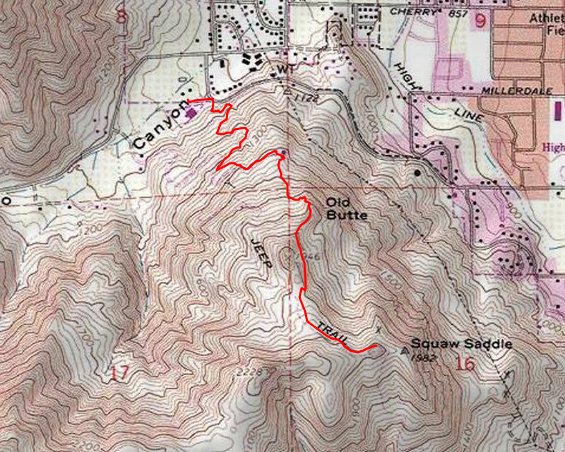
Hike Distance: 3.8 miles Elevation Gain: 1000 feet
Location of Hike: Wenatchee- Saddle Hill
Weather during Hike: Cold
Hiking Buddies: Carly, Gail, Otis and Thor
Start Time: 9:00 AM End Time: 11:00 AM
Hike Distance: 3.8 miles Elevation Gain: 1000 feet
Pictures: Link
We spent Christmas with Carly in Wentachee – Carly said we could do a quick hike the day after Christmas. This trail started out behind her gym and climbed up to a view of Saddle Rock (or Hill – I keep interchanging them). The trail was mostly snow free, but there were a few spots of snow and ice we had to be careful of. Part way up the hill, this was the view looking back toward Wenatchee – you can see the spot where I said Carly’s house is (somewhere in there):

We continued up and soon made it to the hill that overlooked Saddle rock:

While we were up there, Thor and Otis decided to run around and play:

While up there we decided to take a slightly different route back down and hike by Rooster Comb (shown as Old Butte on the map). We snaked our way down, using a faint user trail to get over to more of a proper trail. I didn’t climb up on the rock, but it was pretty much the same view we had the whole trip. This is what Rooster Comb looked like from the backside:

The whole hillside is covered in many trails – some official, some user trails. They head off in many directions.
We continued up and soon made it to the hill that overlooked Saddle rock:
While we were up there, Thor and Otis decided to run around and play:
While up there we decided to take a slightly different route back down and hike by Rooster Comb (shown as Old Butte on the map). We snaked our way down, using a faint user trail to get over to more of a proper trail. I didn’t climb up on the rock, but it was pretty much the same view we had the whole trip. This is what Rooster Comb looked like from the backside:
The whole hillside is covered in many trails – some official, some user trails. They head off in many directions.
It was a short hike, but it was interesting and a neat way to spend a couple of hours.