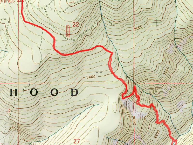
Location of Hike: Corral Springs Trail
Trail Number: 507
Weather during Hike: Misty at first then sunny
Hiking Buddies: Thor
Start Time: 10:00 AM End Time: 3:30 PM
Hike Distance: 5.75 miles
When we got to the abandoned Lookout Springs campground (where the trailhead starts), there was a family camped there. Thor, being Thor wanted to meet them and ran over to them. He made a new friend with their son, who seemed to really like him. The dad asked me about Huxley Lake – how far, how hard, etc. I told him what I remembered from the last time I went down there and told them about the weird side trail to the lake (which tripped me up on my first attempt). When we returned from our hike, they were still in the camp and I asked if they had gone to the lake they said no. Oh well – at least they didn’t get lost.
OK, back to the hike – The beginning of this trail has some nice trees in it and the trail is pretty flat. It goes thru some beautiful old growth forest – a sample of the upper section:

And then after about a mile, it starts the brutal descent into the Roaring River canyon. Shortly, you get a great view of Indian Ridge which is across the canyon (this is near the big rockslide):

At this point, the trail changes quite a bit – it gets steeper, and the trees are much smaller and there are a lot more rhodies. A little farther, I noticed a bunch of White Iris on the trail, which is really interesting because you don’t see that very often:

As you get closer to the river, the trail gets steeper and more faint. Fortunately, there is good flagging where the trail gets really faint. And as you get closer to the river, the trees get larger as well. The lower part of the trail is somewhat like the upper part, except for an abundance of salal (which is the primary reason the trail gets so faint). We eventually arrived at the Roaring River, which wasn’t too Roaring this time of year:

We ate lunch at the campsite (which obviously hasn’t been used for a while):

Once we were done with lunch, we crossed the Roaring River (I took my boots off and waded and Thor swam) and looked for any sign of tread on the other side – we were trying to find the junction with the old 511 trail. The brush over there was brutal, and there are HUGE logs down EVERYWHERE, so moving around over there was pretty tough. A photo of the rootball of one of the downed trees (hiking pole for scale):

So many downed trees:

We did find one possible short section of something that kind of looked like tread, but it was only about 10 feet long. We found no blazes at all. We spent about 30 minutes over there looking for anything, and found nothing. I’m guessing that the maps are correct and at some point Corral Springs got re-routed farther north (its current location) from its original routing. I’m guessing any tread or blazes (if they exist) would be wherever that alignment was. Since we couldn’t really find more 511 tread across the river, I think that end of the 511 is probably gone.
We crossed back over the river – this time I thought I could rock hop, but it turned out that I missed a rock – I ended up getting wet on the far side. But it wasn’t too bad. We headed back up the steep trail, doing some brushing on the way (it allowed me to rest a bit on the long trip back uphill).
This was a burned out stump I noticed on the way back up which I thought was kind of neat:

And I really liked this little area on the way back up – an interesting combination of dying old trees and new trees taking their place:

We made it back up in pretty good time and then headed home. A very nice day in the woods – great way to spend a birthday!

