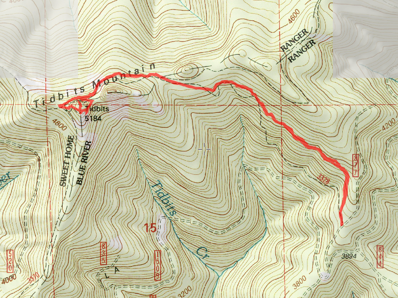
Location of Hike: Tidbits Mountain Trail
Weather during Hike: Sunny
Hiking Buddies: Carly
Start Time: 10:45 AM End Time: 1:25 PM
Hike Distance: 4 miles
I headed from home at about 7am, and headed for Eugene. The plan was to pick up my daughter and head east to the trail. I guessed it was about an hour and a half from her apartment to the trailhead, and it turned out to be pretty close. We got to the trailhead about 10:30 or so.
On the road up to the trailhead (road 1509) we saw this interesting rock formation:

The Sullivan book that I found this trail in said the spur road 877 was steep – boy he wasn’t kidding. It went straight up the hill. Didn’t have any issues getting up there, thankfully. It said this is a lightly used trail. I was kind of surprised, since it seems like a nice trail. Once we found the trailhead, we headed up the trail, and shortly came to the junction where we found the remains of a 1930’s Forest Service Shelter:

After checking out the old remains (and taking a few photos) we continued on. The trail goes thru some beautiful old growth along the way – it is a very pleasant trail and very well graded:

Continuing up (you pretty much are constantly going up on this hike), and when you get near the lookout location, you travel across a rockslide, below this imposing rock peak:

After climbing a bit more, and coming around the peak, and climbing pretty steeply for a short period, you get to the end of the trail, and you can see where the stairs used to go up to the old lookout:

Once you scramble up that hill, you can see the remnants of the old lookout location:

With impressive views in all directions – you are on the top of a rock:


And a not so great video from the lookout location – panning around:
We ate lunch on top, explored the geocache that was there (we didn’t take anything since we didn’t have anything to put back in), and due to the wind, we started getting kind of chilly, so we packed up and headed back down. The book talked of a faint trail that allows you to do a small loop around the peak. We thought we found the faint trail, so followed it down and eventually joined the trail we came up on. It was faint, but not too bad, and it was shorter than the route we came up.
A little farther down the trail, I remembered this tree on the way up and I had to take a photo of it – it fell in EXACTLY the right spot – wedging itself between two other trees:

And I also saw what I think is a crocus, that is blooming really early for 4500 feet! Spring is coming early all over the northwest:

We continued down the trail until we got back to the truck. We decided to head out to the end of the 877 road – it looked like there might be a good view out there. The road wasn’t too bad, but it was obvious it didn’t get a lot of traffic. We went all the way to the end, and we found a very curious sight – a man sitting in his pickup with the engine running, smoking a cigarette. Not sure what we was doing there, but it was kind of weird. It was kind of a wasted trip anyway since there was no view at the end of the road. We turned around and headed back down the road.
On the trip home, we saw this covered bridge and stopped to check it out:

It was built in 1937 and rebuilt recently. There was an interesting interpretive display at one end of the bridge.
We headed back to Eugene and went to “Cornucopia” (I hope I spelled that right) for an early dinner. I had one of the best burgers I’ve ever had there! It was AWESOME! Had some great conversation with my daughter and then headed out to drop her off and finish off my long day of driving.
It was a four star hike!

