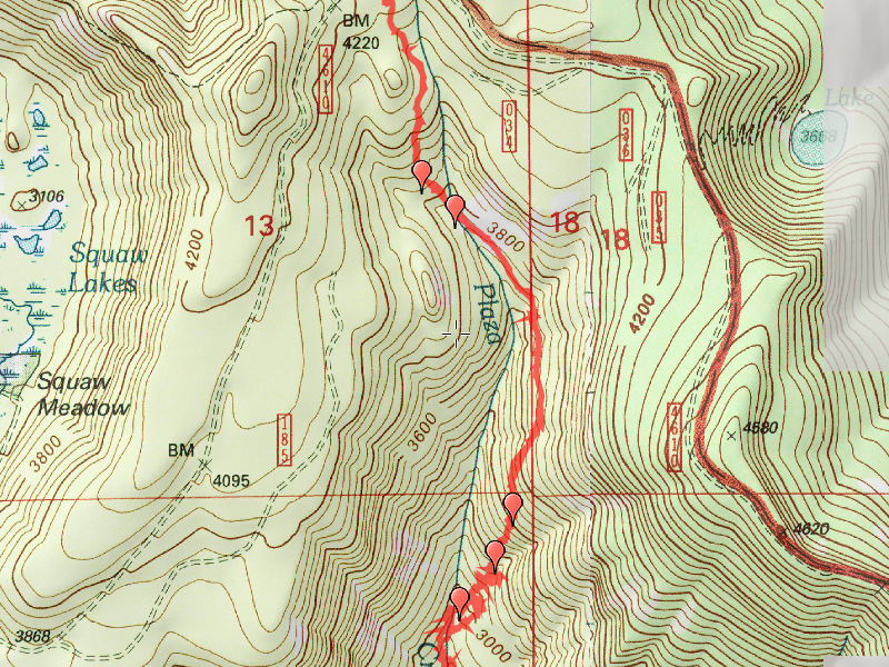
Location of Hike: Plaza Creek Trail
Trail Number: 506
Weather during Hike: Foggy, cold and snowy
Hiking Buddies: Kirk
Start Time: 10:30 AM End Time: 2:15 PM
Hike Distance: 4.4 miles
Started down the road in the old campground (it has been bermed and ditched so that no vehicles can go in there anymore), and found an old sign for the trail. According to that sign, it also went down to Hambone Springs. It said 2 miles to the Roaring River and 8 miles to Hambone Springs. Interesting little bit of forest history.
Wasn’t sure how well we could follow the trail in the snow, but it was easily apparent where the trail was, at least for the first 3/4 mile or so. After that, there was good flagging to guide the way. All the way down to the second crossing of Plaza Creek (or where it meets the creek). At that point, the flags disappeared and we were unable to find any sign of the trail after that. With the trees dripping heavily, we decided to eat a quick lunch and start the long ascent back to the top.
Some neat things to watch for on the trail – – a couple of nice creek crossings, a really neat rockslide, and an interesting rock formation – from the bottom end it looks like a fieldstone chimney!
This was the second to the last trail in my quest to hike all the trails in the Clackamas district. One more to go! (Corral Springs). Even though it was really beautiful today with all the snow, I would like to see this trail in the summertime without it. I think it would have a completely different feel to it.
All in all, a good way to end up the high elevation hiking season.

