Date of Hike: 1/13/2008
Location of Hike: Fish Creek - Old FS Road 54
Weather during Hike: Sunny and cool
Hiking Buddies: Bodie (my dog)
Start Time: 10:30 AM End Time: 2:00 PM
Hike Distance: 6 miles
Location of Hike: Fish Creek - Old FS Road 54
Weather during Hike: Sunny and cool
Hiking Buddies: Bodie (my dog)
Start Time: 10:30 AM End Time: 2:00 PM
Hike Distance: 6 miles
Pictures: Link
Description of Hike:
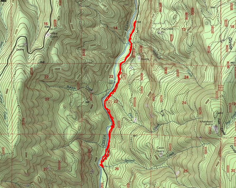
What a beautiful January day for a hike. The weather was cool (high 30’s, low 40’s), but it was sunny with very few clouds. The plan was to go up fish creek, on what used to be FS road 54 and hopefully get to the second bridge (about 5 miles in). I wanted to be able to test out my new hiking boots (Salomon) and GPS (Garmin 60csx) that I got for Christmas. Well, I didn’t even get to the first bridge, which is about 3-3.5 miles from the start. There was LOTS of snow! anywhere from 4-10″ of pretty soft snow, and I didn’t have snowshoes, so it was pretty tough going. Couple that with the water flow in some of the creeks you have to cross, and it was a difficult day for me and my dog. We ended up turning back at the second creek (the name of the creek-it is actually the 3rd creek you have to cross) crossing. It was running pretty fast and deep. Normally, I take a large tree over the creek, which works great. This time, it was covered it about 6″ of snow, and I didn’t want to slip off of it in the middle. It is about 8′ or so down to the creek. I was getting tired, I had Bodie with me, and my better judgement told me it was time to turn around. So, we ended up doing about 6 miles. It was still a VERY nice trip, and it was wonderful getting out in the woods again. I have to say my boots performed very well (although they were a little stiff), and the GPS did very well, too. You can see the two maps with the overlaid track on them in the pictures. After the hike, I thought I would see if I could get up to see the damage on road 63 where it is closed. Short story – I couldn’t. There is a LOT of snow up there! I don’t think I’ve ever seen this much snow this low. Highway 224 was plowed to Ripplebrook, and road 46 was semi plowed for about a mile or so. After that, it was kind of plowed. There was one lane, with two tire tracks, with about 2 feet of snow on either side and about 6″ of snow between the tire tracks. I drove up this until just about the Riverside trailhead, and had to turn around. There were 5 or 6 cars and trucks, and it looked like there was either an accident or someone was stuck. I honestly don’t know why someone in a car would go on a road like that. I’m guessing they were trying to get up to Bagby Hot Springs. All in all a very enjoyable day.

